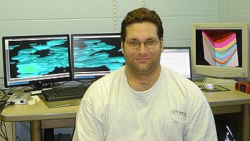
Damion Knudsen research highlights 2007-2008 An Investigation into Subsurface Sampling and Characterization Efficiency Using a High Resolution GIS Based Earth System

Damion Knudsen is an M.S. (Environmental and Conservation Sciences) student at North Dakota State University in Fargo, ND. He graduated with a B.S. in Geology from NDSU in May of 2005. As an undergraduate, Damion developed an interest in geographical information systems and subsurface geostatistics which led him to continue with his graduate studies at North Dakota State University. Damion’s research interests include three dimensional geostatistical modeling of subsurface analyte distributions in regards to economic optimization of subsurface site characterization management.
Damion.Knudsen@ndsu.edu
Phone: 701-730-1398
Fellow: Damion Knudsen, Geosciences Department, NDSU
Advisor: Dr. Bernhardt Saini-Eidukat, Associate Professor and Chairman of the Department of Geosciences, North Dakota State University
Matching Support: NDSU
Degree Progress: M.S. in Environmental and Conservation Sciences expected December 2007.
An Investigation into Subsurface Sampling and Characterization Efficiency Using a High Resolution GIS Based Earth System
Groundwater polycyclic aromatic and chlorinated hydrocarbon containing non aqueous phase liquid contamination is a major issue affecting people’s health and the vast amount of money being used to remediate it. The majority of investigators of non aqueous phase liquid contaminated sites currently use traditional sampling methods such as hollow stem auger coring, hand held photo-ionization detectors, visual confirmation, and laboratory analysis to determine the extent of a subsurface contaminant source zone. These methods are time consuming, costly, and can create large amounts of waste. Improving upon traditional site characterization methods using direct sensing instruments such as laser induced fluorescence can greatly reduce the time and budget constraints of site characterization. Investigators may now be able to understand the extent of contamination and create draft or preliminary 3-D models in situ and in real time while still in the field. Shallow subsurface direct sensing instruments are comparable to measurement while drilling and geophysical wire line bore hole instruments used in the oil and mining industry. Direct sensing, measurement while drilling, and wire line instruments usually collect large amounts of data preceded or followed by traditional sampling methods used for calibration and data verification. Many times in environmental investigations both direct sensing instruments and traditional sampling methods will be operating on a site at the same time with direct sensing instruments finding hotspots in order to guide traditional sampling methods.
These concepts are in agreement with a growing movement of site characterization experts at the Environmental Protection Agency, who emphasize that a greater number of lower cost, higher density measurements such as directly sensed data, followed by lesser amounts of higher cost traditional sampling, is more effective in the characterization of source zone groundwater contamination. With direct sensing instruments such as laser induced fluorescence between 4,000 and 40,000 semi-qualitative and semi-quantitative measurements are collected depending on the size of the site and the degree of accuracy of the characterization desired by the site investigator. This is in comparison to at most a few dozen core samples that might be taken from a site using traditional sampling methods. In current practice, sample boring locations are often based on little more than gut-feel with pen and paper maps. Alternatively, computer derived or guided sample locations would be expected to decrease source zone interpolation uncertainty and optimize sampling locations. The combination of intelligent location selection and real time feedback via direct sensing instruments should produce a significantly more efficient site characterization. This is important in light of the budgetary, time, and spatial limitations investigators are often dealt. Direct sensing instruments are of higher resolution than traditional sampling methods and provide a more resolute model of the contaminant source zone.
Objectives and Methods :
- Conduct a literature review on different methods, instrumentation, and geostatistics of subsurface site characterization.
- Characterize using modern geostatistical theory and geographic information systems, directly sensed groundwater contaminant data from Morton and McKenzie County, North Dakota, and a site in Codington County, South Dakota.
- As high resolution three dimensional models of subsurface contaminant distributions are created, computer simulations will investigate different 3-D sampling densities and provide an optimized method or workflow for investigators while also providing economic constraints given certain model accuracy values.
Progress to Date:
I have produced high resolution three dimensional models of subsurface contaminant distributions to be used in the simulator. Computer simulations are underway investigating different 3-D sampling densities. Budgets are being given to the different simulated sampling methods in attempts to quantify model accuracy versus total project cost.
Significance:
I am researching improvements that can be made by merging old and new technology with regards to site characterization and management of three dimensional subsurface analyte distributions. Groundwater contamination has been indicated in community increases of certain rare cancers and health issues. One example of this would be Love Canal in New York in which many people were exposed to toxic fumes from hazardous waste that migrated with groundwater through the subsurface into living areas. In 2004 the EPA published a report stating that much research still needs to be done on understanding dense non aqueous phase liquid groundwater contamination with regards to not only the transportation of these dissolved chemicals through the subsurface but also of their free phase source zones. New research and observations as of late have led to statements that source zone depletion is becoming an even more effective method of groundwater remediation instead of just treating the dissolved phase constituents of groundwater contamination.

Bernhardt Saini-Eidukat
Geosciences
Office: Stevens 127
Telephone: 701-231-8785
Email: bernhardt.sainieiduk@ndsu.edu


