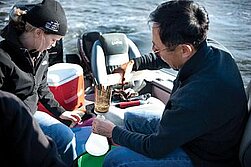
Assessment of Water Quality in Devils Lake using Satellite Imagery

Kate Overmoe-Kenninger is a PhD student in the Earth System Science & Policy program at the University of North Dakota. She holds a Master of Science degree in Environmental and Conservation Science from North Dakota State University and a Bachelor of Science degree in Fisheries and Wildlife Biology and Bachelor of Arts in Spanish both from the University of North Dakota. Her current research focuses on applying satellite imagery to assess water quality in lakes and reservoirs of North Dakota, primarily Devils Lake.
kate.overmoe@und.edu
Phone: 701-777-2490
Fellow: Kate Overmoe-Kenninger
Advisor: Dr. Xiaodong Zhang, Ph.D., Associate Professor, Department of Earth System Science & Policy, University of North Dakota
Degree Progress: Ph.D. in Earth System Science & Policy expected graduation fall 2013
Assessment of Water Quality in Devils Lake using Satellite Imagery
The primary cause of impairment in North Dakota lakes and reservoirs is nutrient loading (NDDOH 2010), leading to eutrophication as primary productivity increases in water due to natural or artificial nutrient enrichment, typically nitrogen or phosphorus (Schwoerbel 1987). High nutrient levels in water bodies have numerous negative effects, including nuisance or harmful algal blooms, anoxic conditions, changes in water temperature, increase macrophyte production, population shifts in both plants and animals, and reduction in water clarity (Hoagland & Franti 2008).
Water clarity is the measurement of the distance that light penetrates a waterbody and is an indirect measurement of a lake's trophic status, in terms of nutrient concentration and biological productivity (Brezonik et al. 2007). Measurements in water clarity are useful due to both the overall human-use perception of quality in addition to the abundance of algae (Brezonik et al. 2007). Because of its ease of use and low cost, the Secchi disk is a common tool in field measurements of water clarity.
Measurements of water quality using traditional methods in the field can give accurate measurements but are not always accessible or convenient. In addition, high costs of ground monitoring typically results in the favoritism toward fewer lakes for more frequent sampling and thus limits the spatial coverage of an area (Kloiber et al. 2002a). Landsat images are useful in inland lake water quality due to temporal coverage, spatial resolution, and data availability (Kloiber et al. 2002b, Nelson et al. 2002, Krizanich & Finn 2009). Secchi disk transparency (SDT) is the most commonly measured trophic state indicator and is strongly correlated with the spectral reflectance in the blue and red bands of the Landsat TM/ETM+ data (Kloiber et al. 2002a). The overall goal of the proposed study is to develop a remote sensing based model that will be used to monitor the long term variation of water quality in North Dakota waterbodies.
Project Objectives:
The overall goal of the study is to develop a remote sensing based model that will be used to monitor the long term variation of water quality in Devils Lake. To accomplish the goal, the following objectives will be pursued:
- Derive empirical relationship between in situ measurements of Secchi disk transparency and spectral reflectance of Landsat TM/MS data over Devils Lake
- Establish a long term record of water quality information on Devils Lake
- Evaluate the climatic impact on water quality variation
- Verify if long term trends in water clarity of Devils Lake is related to land use/land cover
Progress:
Historical water quality data and data locations within Devils Lake have been obtained from EPA STORET and USGS databases. Acquisition dates of Landsat overpass have been coordinated with the water quality sampling locations, dates and associated water quality parameters. The collection and processing of Landsat TM/MS imagery is currently in progress. The first field season took place in the summer of 2011.
Significance:
The United States Environmental Protection Agency (USEPA 1998) indicates that lakes and reservoirs possess 168,349 km2 of land and are a critical supply of drinking water for the United States. Not only are these waterbodies essential to sustain life but are key economic elements in industry, irrigation, and hydropower. However, water quality issues associated to human activities has become an ever-increasing concern of the nation (USEPA 1998). Therefore, it has become necessary to establish water quality monitoring to protect the nation's waterbodies. Measurements of water quality using traditional methods in the field can give accurate measurements but are not always accessible or convenient. In addition, high costs of ground monitoring typically results in the favoritism toward fewer lakes for more frequent sampling and thus limits the spatial coverage of an area (Kloiber et al. 2002a). Landsat images are useful in inland lake water quality due to temporal coverage, spatial resolution, and data availability (Kloiber et al. 2002b, Nelson et al. 2002, Krizanich & Finn 2009). A state-wide study of North Dakota's lakes and reservoirs has been proposed here however, elements of this study have the potential to be adopted nationwide.

Xiaodong Zhang
Earth System Science & Policy
Office: Clifford Hall, Room 300
4149 Campus Road - Stop 9011
Grand Forks, ND 58202-9011
Telephone: 701-777-2490
Email: xiaodong.zhang2@UND.edu


