3D mapping techniques for soil channelization in agricultural fields using Aerial and digital camera LiDAR and GIS

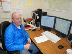
Rick Thalacker is a Master of Science student in Geography at the University of North Dakota. He holds a Bachelor of Science in Land Use with a Geology emphasis and GIS certification from Metropolitan State College of Denver. This research is focused on 3-D mapping techniques for soil channelization in agricultural fields using digital camera LiDAR and Structure from Motion (SfM) techniques and GIS.
Email: rick.thalacker@my.und.edu
Phone: 720-371-2095
Fellow: Rick J Thalacker
Advisor: Gregory S. Vandeberg, Ph.D., Associate Professor and Graduate Director, Department of Geography, University of North Dakota.
Degree Progress: M.S. in Geography expected graduation in spring 2014.
3D mapping techniques for soil channelization in agricultural fields using Aerial and digital camera LiDAR and GIS
- Soil erosion is a worldwide problem that can negatively impact surface water through the introduction of sediment, nutrients (eg. nitrogen, phosphorus), pesticides, and other chemicals. These pollutants can be toxic to aquatic and terrestrial biota, as well as impact anthropogenic uses of surface water for drinking, agriculture, and industry. Soil erosion is often exacerbated by agricultural and other types of land use. In North Dakota, more than 28.1 million surface acres are in cropland, and 9.9 million in rangeland. The North Dakota State Water Commission has identified soil erosion as a concern in contributing to sedimentation in lakes and reservoirs. In particular, soil erosion in the Red River basin has been identified as a problem due to the loss of soil, and the pollution of lakes and streams. Local soil conservation districts work with local producers, the Natural Resource Conservation Service, and other state and federal agencies to implement best management practices to reduce the amount of soil erosion. Identifying locations prone to soil erosion can help agencies to prioritize their efforts for implementing best management practices.
- The identification of soil erosion or soil erosion potential has been addressed using many different techniques. Erosion surveys allow for on the ground mapping and/or the use of aerial photos to map erosion. These surveys can be time consuming and expensive. Erosion indexes and rainfall intensity have also been used to map erosion, or erosion potential. Empirical and process-based models such as the Universal Soil Loss Equation (USLE), Revised Universal Soil Loss Equation (RUSLE), Water Erosion Prediction Project (WEPP) and Surface and Water Assessment Tool (SWAT) allow for the prediction of sediment runoff as well as changes to runoff and water quality based on different management and cropping scenarios. These methods evaluate overall erosion, or loading to local surface water, but do not pinpoint locations of increased erosion potential.
- The purpose of this study is to identify and model soil erosion or potential soil erosion using Digital Camera LiDAR to create high resolution Digital Elevation Models (DEM’s) in a GIS.
Project Objectives:
- Identify critical areas of surface erosion identified by gullies, and inlets from agricultural ditches to the upper Turtle River and Forest River watersheds of North Dakota using SPI. The identification of these critical areas will allow for the implementation of precision conservation techniques to decrease impacts to surface water quality. The results of this pilot study can be translated to the greater Red River valley area to identify critical areas of erosion.
- To investigate soil erosion and how to best identify, model and represent soil channelization using a new and exciting remote sensing technique referred to as “digital camera LiDAR” using “Structure from Motion” (SfM) techniques and software.
- The results of this study will be used to compare data between airborne LiDAR and digital camera based LiDaR data of the Red River Valley. This research promises to be a new and economical approach to creating field-scale LiDAR data sets for erosion and other studies using free open source software and digital cameras. The proposed study areas are the upper Turtle River and Forest River watersheds in Grand Forks and Walsh County, ND.
Progress:
The applicant is in his second semester of graduate research currently working on software models to be used with field-based data.
Significance:
Stream Power Index’s (SPI’s) created from Digital Elevation Models (DEM’s) will be produced to identify potential critical erosion areas adjacent to the Turtle and Forest Rivers above Larimore and Fordville dams. As part of this study, the models produced from the airborne vs. digital camera LiDAR will be compared. SPI’s at or above critical erosion levels can be used to target precision conservation in individual fields adjacent to the Turtle and Forest Rivers. This information can be used by landowners, the local Soil Conservation District as well as the Red River Resource Conservation and Development Council. A comparison between the airborne LiDAR and digital camera LiDAR will help to determine the viability of using digital camera LiDAR for applications such as this. The results of this research will be submitted to a journal such as Catena or the Journal of Environmental Quality.
Thesis:
Physical Model Studies of Scour Holes Below Singular and Multiple Step Rock Weirs

Gregory S. Vandeberg
Geography
Office: O'Kelly Hall Room 161
221 Centennial Dr Stop 9020
Grand Forks, ND 58202-7088
Telephone: 701-777-4588
Email: gregory.vandeberg@UND.edu


